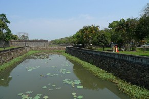
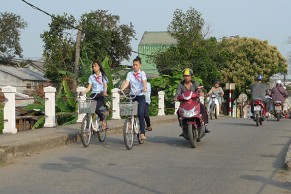
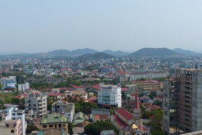
 Huê´ sits at the mouth of the Tam Giang lagoon and Huong River estuary. With most of the land outside the citadel not much more than one meter above sea level, it has always been a low-lying landscape permeated by water. Historically, semi-annual monsoon rains have brought much-needed rainfall and carried rich sediments downstream, supporting two crops of rice each year and a lagoon teeming with fish and shellfish. These rains have been central to life in Huê´ for centuries, with many permanent buildings in the floodplain using subtle grade and landform changes to accommodate annual flooding of up to one meter.
Recently, however, the monsoon season has become more unpredictable, bringing more frequent, heavier rainfalls and larger floods, while the lagoon has become more susceptible to storm surges and tidal waves. On November 3, 1999, Tropical Storm “Eve” brought just such an event with a simultaneous cascade of rainfall that quickly overflowed the Huong River’s banks and a storm surge that overran the lagoon. In a matter of hours, floodwaters reached heights of up to seven meters in some locations that did not reside for days. While the central city saw considerable damage, many residents were stranded and fishing villages in the lagoon were almost completely destroyed.
Weather patterns due to climate change suggest that these kinds of storms will happen with greater frequency and severity, and climate scientists are projecting mean high tide water levels to increase by up to one meter by the end of the century, endangering freshwater supplies and increasing susceptibility to storm surge. Since measurements began in the late 1970s, the water level has already risen 16 centimeters; farmers have already transitioned freshwater rice fields at the edge of the lagoon to saltwater shrimp farming.
Huê´ is experiencing growth and change in the context of these environmental changes, and the regional government has begun to respond with “hard” engineering solutions to provide safety from flooding and other dangers. Two new dams have recently been constructed in the upstream area of the Huong River that reduce risk of flooding, but also reduce the supply of sediments that would otherwise replenish local agriculture, enrich the lagoon, and limit the erosion of the shoreline. Newly constructed levees in the downstream area keep encroaching saltwater out of rice fields, yet limit tidal flows that result in increased sedimentation, reduced navigation, and polluted freshwater supplies.
Hard engineering solutions, however, are invariably expensive, and in some cases, require additional, and even more expensive, engineering solutions down the road. The local authorities have reached out to foreign investors who can help to provide new infrastructure while bringing development to coastal and rural areas around Huê´, and are contemplating amendments to the city’s Management Plan to accommodate such changes. Rice paddies, farmland, and rural villages in between the citadel and the coast would be given over to development. River and shoreline edges would be hardened, while roads and other infrastructure would be modernized. Developers seeking short-term return on their investments would speculate.
 Although private property rights are strongly valued throughout Vietnam, discussion of such development is not always publicly accessible or transparent, so much of this occurs without consulting the local people.
This approach to development raises several long-term issues. While people have endured in this environment for centuries, the center of Huê´ is located significantly inland, along a wide bend of the river that has likely always been more resilient to flooding. It can be argued that the form of the city has in the past helped people to be naturally resilient to disasters, with rice paddies and other agricultural areas on unstable land providing natural flood plains for waters to collect, and soft river edges, farmlands, and wetlands functioning as natural sponges outside the urbanized area. Historically, those who did live in or near the lagoon lived in temporary structures or arrangements that would often allow for quick recovery after disaster (such as the rapidly disappearing tradition of living in sampans.
As new development occurs, the loss of cultural heritage and natural environmental protection can go hand in hand, and land use decisions are often made today without consideration for the resilient techniques of the past. More permanent development patterns in the river’s floodplain will be more difficult to repair and maintain after floods and storms that arrive with increasing frequency.
This brings us back to heritage preservation, and some direction for providing an appropriate “buffer area” around the historic monuments mentioned in my previous post. Would Huê´ be the same if it were continuously developed between the historic citadel and the lagoon? And given the serious environmental constraints confronting the region, should it be? Huê´ will and should grow, but could Huê´ grow in a more compact manner? And if so, could it present a land pattern that more carefully considers heritage preservation and a softer, more resilient approach to environmental protection?
The six teams of young professionals that were organized during the workshop used this inspiration when focusing predominantly on “soft” planning and design solutions. One group looked at heritage access in the upstream area of the river near the Gia Long tomb complex, focusing on improving the relationship between the historic tombs and the surrounding rural villages, and the restoration of their interconnected wetland irrigation system. Another group looked at Thuy Bieu, a neighborhood of rural plantations just upstream from the citadel and home to some of the most fertile agricultural lands in the region, demonstrating how the existing agricultural pattern could be preserved and allowed to evolve rather than erased by new development. The third group looked at the historic portside village of Bao Vinh, demonstrating how incremental improvements and selective infill and redevelopment could overcome current flood hazards and provide new and revitalized public spaces over time. The fourth group looked at the Tam Giang lagoon, proposing the expansion of a tidal estuary, the protection of the coastal shoreline, and the revitalization of existing fishing villages.
The final two groups focused on a more regional scale. One group concentrated on the Huong River and how context-sensitive public access and connectivity could be improved. The final group addressed the region as a whole, and weighed the anticipated land use changes in the context of the entire watershed. We proposed that the watershed should serve as the appropriate “buffer zone” for the world heritage monuments. Policies could be established to limit development of sensitive environmental lands, preserve cultural heritage, and maintain public access to the monuments, Huong River, and shoreline. A special planning board could be given jurisdiction over this area to facilitate discussion regarding development proposals within.

The work was presented to a group of local officials and experts who had been convened to discuss the project proposals, recommending a cautious approach when pursuing new development. This seemed to resonate, as many were skeptical regarding proposed amendments to the Management Plan. At the same time, they were eager to see economic development in Huê´ on par with its regional competitors, and were wary of limitations on future development—not to mention stronger controls on private property. They urged a continued discussion regarding our team’s findings in the context of the Management Plan updates, as well as continued community involvement and transparency in decision-making.
It was not too long ago that we confronted similar, large-scale planning issues in the San Francisco Bay Area, at a time when outcomes regarding change and preservation must have been equally unclear. In 1961, in response to the loss of an average of 2,300 acres of the San Francisco Bay to fill each year, continued environmental degradation, and privatization of the bay’s edge, a group of community advocates began the Save the Bay movement to protect the bay and open it up to public access. Responding to public advocacy, the state of California passed legislation and created the Bay Conservation and Development Commission in 1965, enacting plans and policies to regulate development around the bay, and establishing public procedures to review projects within its jurisdiction. While in 1961 only four miles of shoreline were open to the public, over 200 miles of bay shoreline are accessible today and the diminishing size of the bay has reversed with the recent restoration of over 100,000 acres of wetlands.
At the time, opponents argued that increased regulation would inhibit economic development and that the Bay Area would lose its competitive edge. After 50 years the legacy of the BCDC illustrates that a successful balance between development, environmental preservation, and public access in coastal areas is possible. Remarkably, these efforts were established without precedent and without the knowledge we have today: In 1965, no national or
state legislation had yet been adopted protecting the environment, regulating clean waters, or preserving historic heritage. Sea level rise and climate change were not known dangers. Today we still grapple with these issues, but the comprehensive, long-range vision that was established provides an ongoing, public platform for their discussion and consideration, helping to ensure our continued resilience to hardships and natural disasters.
It is hoped that the workshop will have a lasting effect as Huê´ continues to rapidly modernize. Perhaps the legacy of conservation and regional planning in our own Bay Area can serve as a useful precedent. Continued dialogue with stakeholders will be necessary in order to advocate for a similar, long-range approach. The exchange of ideas between young urban design and planning professionals and the citizens of Huê´ helped bring these issues to light.
Featured image courtesy of Kushal Modi, UC Berkeley, and Elizabeth DeFrance, Grenoble School of Architecture. This project was featured in the July-August newsletter from the Northern Section of the California Chapter of the American Planning Association. Read more here.