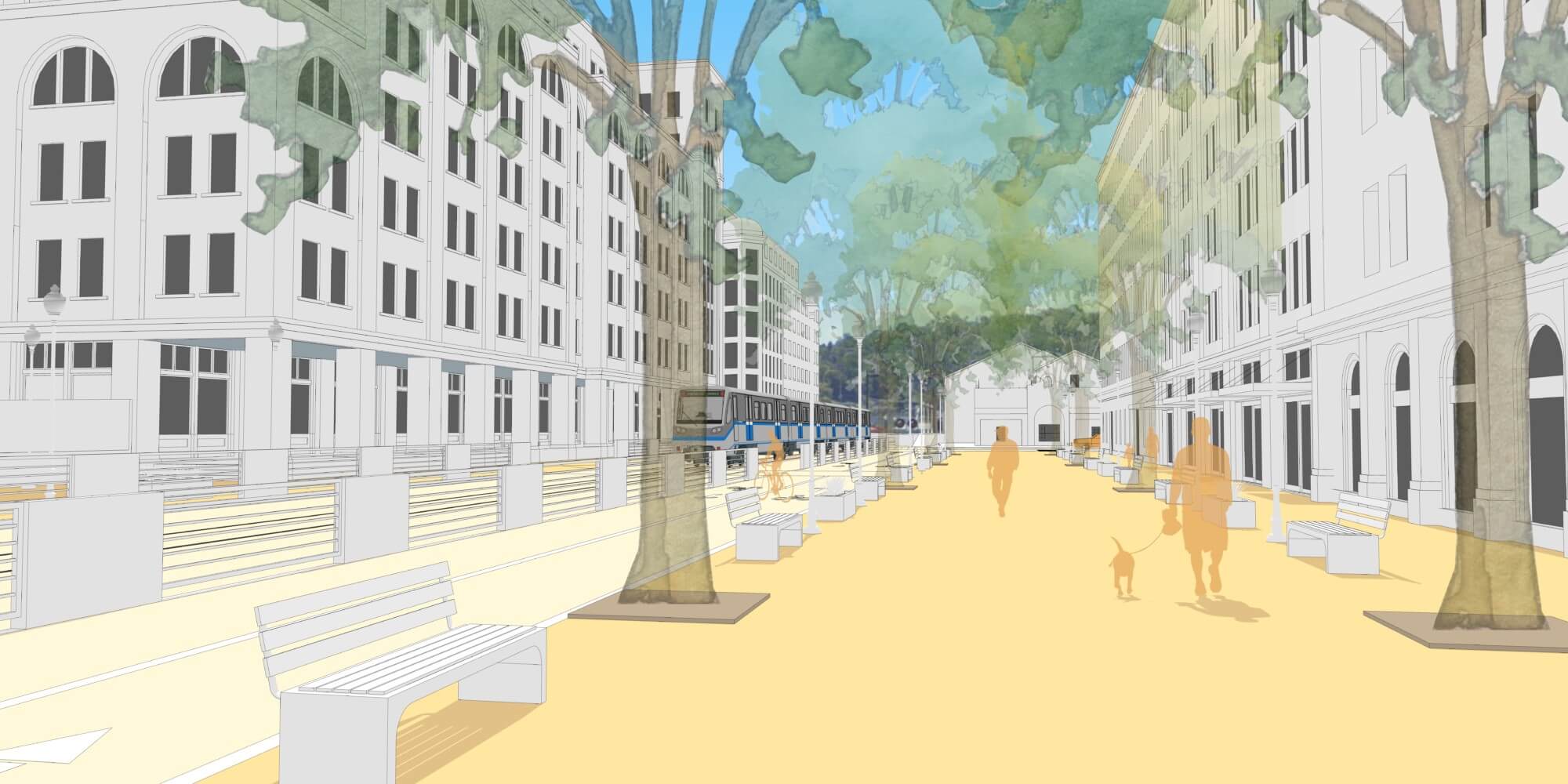
As more cities acknowledge residents’ desire to rely less on cars and more on bicycles and public transportation, they’re looking for opportunities to redesign public community spaces. In early 2019 after a competitive bidding process, Opticos contracted with San Rafael, a bustling California city in Marin County in the San Francisco Bay Area, to help transform their historic Downtown into a modern, mixed-use destination transit hub. First linked to San Francisco via the North Pacific Railroad in 1871, today San Rafael is a vital employment center and a regional transit hub, with a Downtown Station for SMART passenger rail, and a Transit Center with over 500 buses and the second highest number of boardings across all Bay Area stations. San Rafael’s 265-acre historic Downtown is a designated Priority Development Area (PDA), which means it has been planned as a strategic location for new housing, jobs, and community amenities in the face of the regional housing crisis. Following this PDA designation, the city secured One Bay Area Grant funding from the Metropolitan Transportation Commission to facilitate the development of San Rafael’s Downtown Precise Plan in parallel with an update to the City’s General Plan. Working closely with city staff and passionate residents, Opticos Design has developed a community-driven Downtown Precise Plan that envisions and plans for the City’s next 20 years.
Noting Opticos as a team of experienced leaders in downtown planning, urban design, and Form-Based Coding, San Rafael recognized the potential for a partnership that could respond to the urgent need for new housing in Downtown while remaining sensitive to its valued historical context and capitalizing on transit resources. In addition to enabling more housing choices in Downtown, Opticos addressed the housing crisis head-on through an Affordable Housing and Anti-Displacement Strategy that contains guidance for equitable growth. The potential development yield envisioned by the Downtown Precise Plan over the next 20 years includes 2,200 new residential units housing a population of 3,740, as well as 698,000 square feet of non-residential development providing 2,020 new jobs.

Key Elements and Form-Based Code Help Improve Upon Cumbersome Regulatory Structure
Key elements of the Downtown Precise Plan’s urban design vision are mixed-use development at important nodes to strengthen Downtown identity, an enhanced public realm with new public spaces, and a redesigned street network that better provides for the needs of bicyclists and pedestrians. Fourth Street, Downtown’s historic “Main Street”, could be reimagined as a Shared Street that prioritizes safe bicycle access and foot traffic as well as flexible space for outdoor dining and events. In a post-COVID-19 environment, this vision can help reestablish Downtown as a place for people to gather and accelerate economic recovery. The Opticos team refined the design vision for all urban design moves through detailed site testing for public realm improvements, and 3D massing studies for potential development. For example, massing and shadow studies were used to establish maximum building heights that preserve solar access on the north side of Fourth Street.
The Precise Plan is implemented by a Form-Based Code that furthers the Precise Plan’s policy goals through its regulatory standards. The code promotes a range of building forms that establish a visual hierarchy in different areas of Downtown, creating mixed-use development and public realm improvements at nodes and gateways. Building massing and frontage standards reinforce Downtown’s eclectic urban fabric and active streetscape. Historic resource adjacency standards ensure that new development will be contextually appropriate to Downtown’s treasured historic resources. The Form-Based Code seeks to improve upon the current cumbersome regulatory structure by providing clear expectations to future developers and a more efficient pathway to development approval.

Community Engagement Vital in Ensuring Successful Plan Adoption and Implementation
Community engagement was vital in developing the Precise Plan and Code, and community support will be a key factor in ensuring its successful implementation. The design vision was developed through robust community engagement including a multi-day Design Charrette, pop-up workshops, and close interaction with the General Plan Steering Committee, and an online platform called Neighborland to increase opportunities for participation. This multi-faceted outreach and invaluable collaboration helped the design team draft a plan that accounts for the desires and concerns of diverse stakeholders while developing community ownership of the policies and regulations.
The Precise Plan and the Environmental Impact Report (EIR) have been under public review for the past several months. The Planning Commission recently recommended that the plan head to City Council for adoption. By late summer 2021, the Downtown Precise Plan will be officially instated as a formal policy and regulatory document to guide future development and investment in this treasured Downtown.